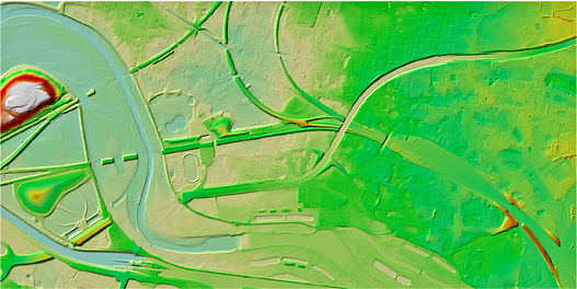
Digital Elevation Models

The digital terrain or elevation model (DTM & DEM) created from LiDAR data is extremely accurate and is a quick solution to get a surface for a very large area. This includes heavily wooded and vegetated terrain. A digital elevation model is a 3D representation of the terrain elevations found on the earth’s surface. DEMs are generated from variably-spaced Lidar ground points, or they can be created using a raster grid. A Digital Terrain Model (DTM) is a DEM in which terrain data has been further enhanced with Breaklines, creating greater accuracy as it contains additional information defining terrain in areas where Lidar data alone is unable to do the job effectively.
SISL creates high quality Digital Elevation Models (DEMs) to support specialized applications such as 3D modeling, powerline as-built surveys. SISL also generates fully detailed Digital Terrain Models (DTMs) for contour generation, orthophoto rectification, and flood plain mapping.


